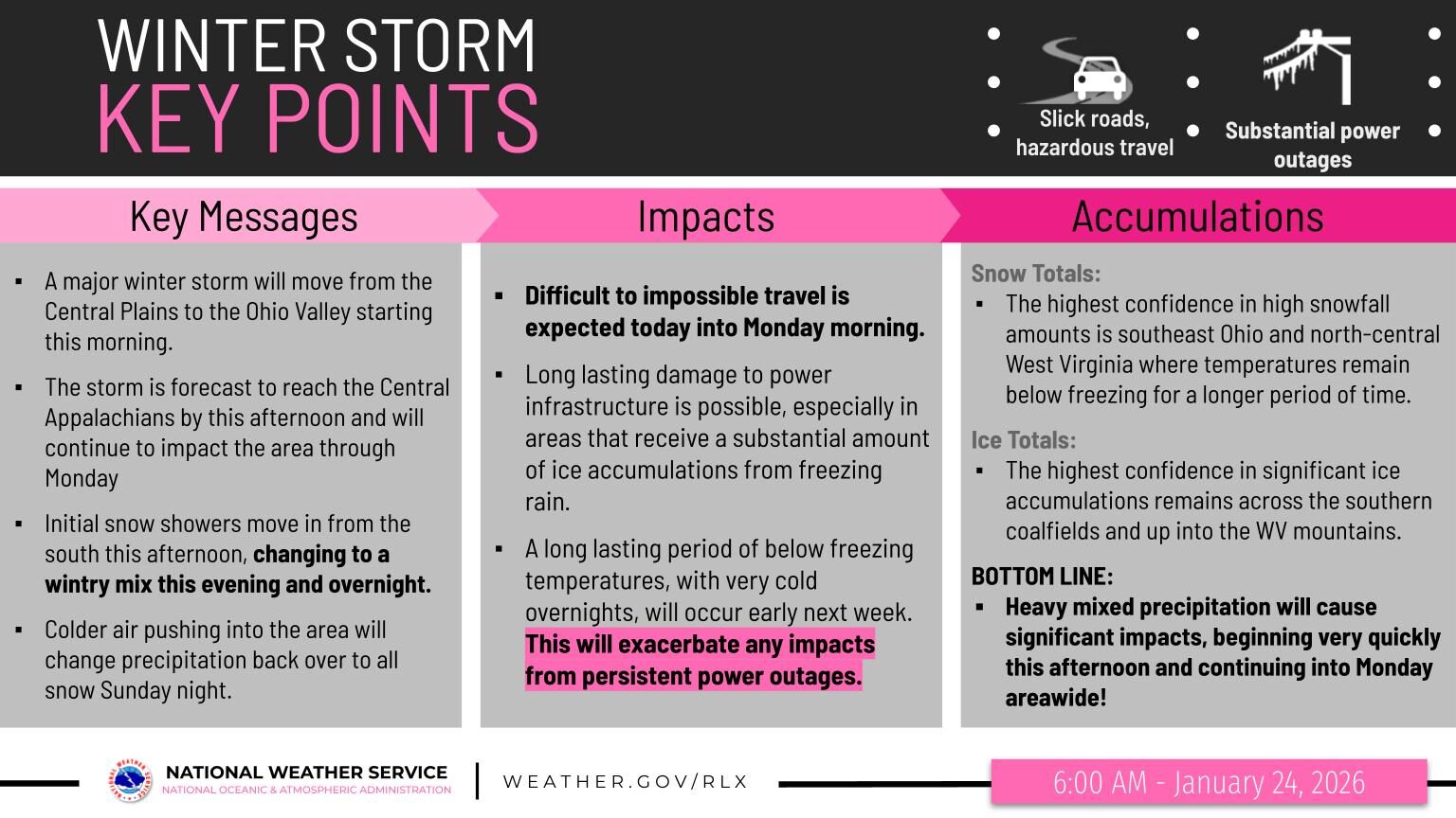
BECKLEY, WV( LOOTPRESS) – Confidence remains high that a major winter storm will move into the region late this morning, with hazardous conditions expected to last through the start of next week.
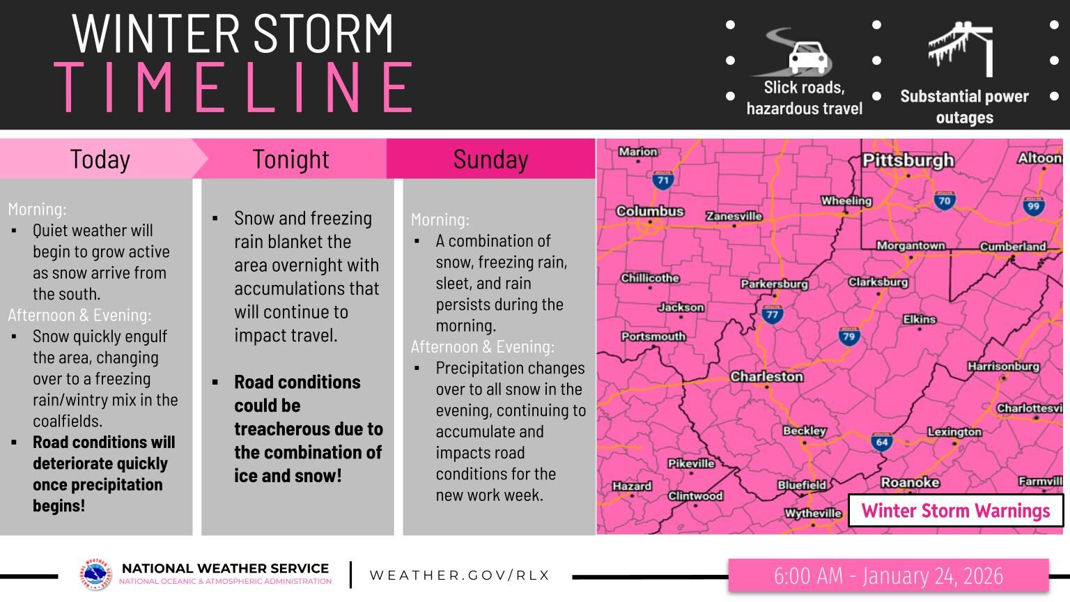
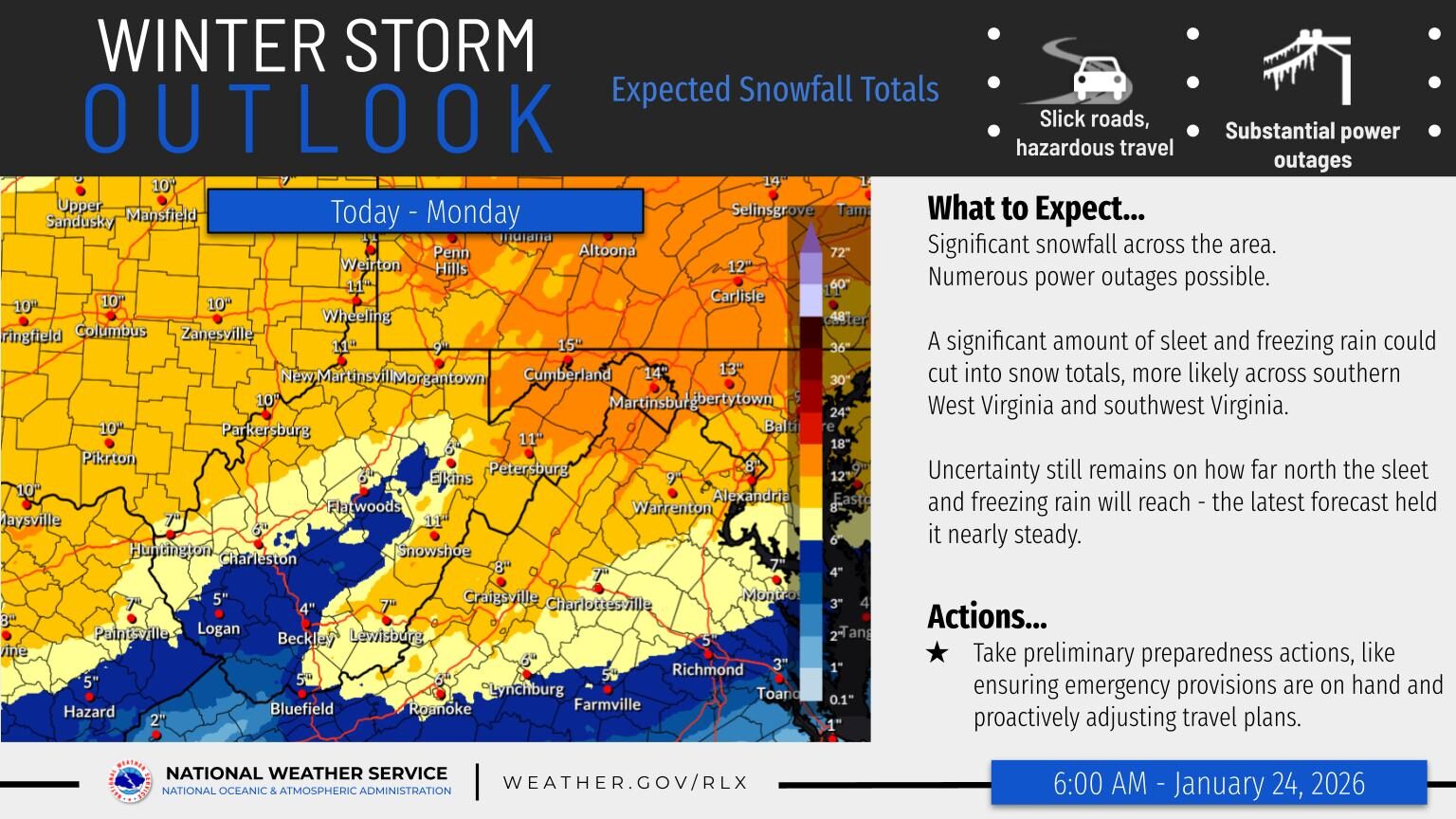
Forecasters say precipitation will spread across the area by this evening and continue through Monday, bringing a prolonged mix of snow, sleet, and freezing rain. Snowfall totals are expected to vary widely by location. Parts of the southern coalfields may see only a few inches of snow as sleet and freezing rain limit accumulation, while the northern West Virginia mountains and portions of southeast Ohio could receive up to a foot of snow where precipitation remains mostly snow throughout the event.
A key concern will be a surge of warmer air aloft moving in from the southwest tonight into Sunday. This will likely cause a changeover to freezing rain, especially across the southern coalfields and areas up into and just west of the West Virginia mountains. Significant ice accumulations are possible in these regions, increasing the risk of power outages and downed trees.

Winter Storm Warnings are set to take effect this morning for the entire forecast area, as confidence continues to grow that this storm will bring major impacts. The combination of snow and ice from now through Monday is expected to create treacherous road conditions, making travel difficult to impossible at times.
Emergency officials urge residents to take preparedness steps now, including stocking up on essential supplies and adjusting travel plans to avoid being on the roads during the worst conditions.
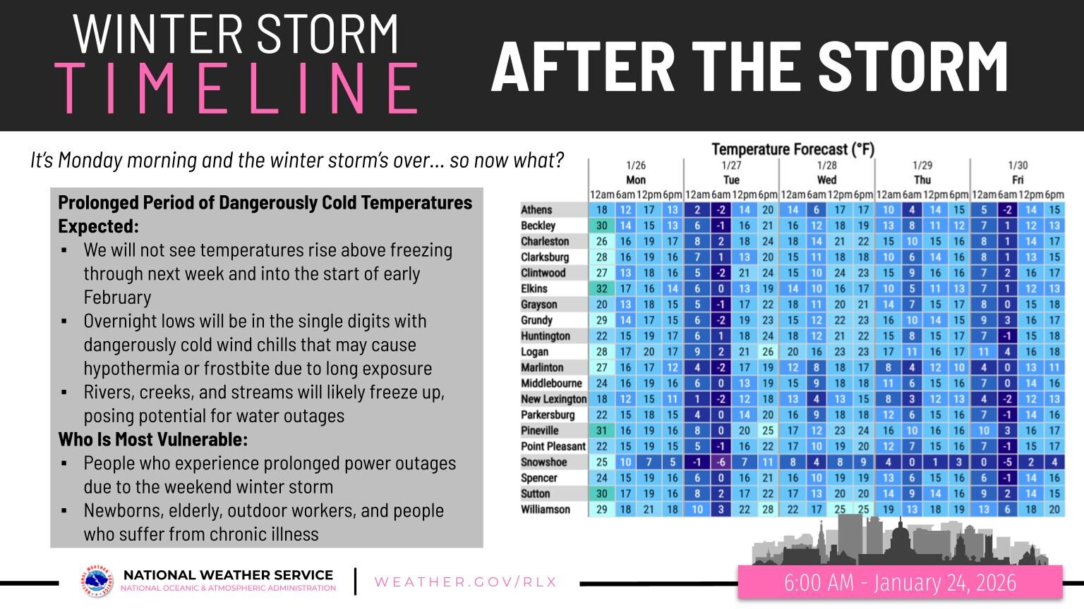
After the storm system moves offshore Monday, the danger will not be over. Arctic air is expected to pour into the region, bringing well-below-normal temperatures through the end of January and into early February. Overnight wind chills are forecast to plunge below zero, posing a serious threat to anyone without reliable heat—especially those affected by prolonged power outages.
Bottom line: Significant impacts are expected from this afternoon through Monday across the entire area due to heavy mixed precipitation. Travel may become impossible at times, and dangerously cold conditions will follow the storm. Residents are urged to prepare now and stay weather-aware in the days ahead.