
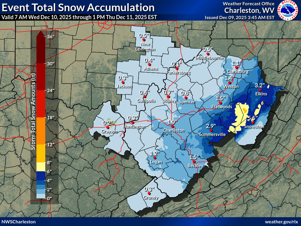
WEST VIRGINIA (LOOTPRESS) – A winter storm watch has been issued for multiple counties in West Virginia, with heavy snow and strong winds expected to impact travel and potentially cause power outages starting Wednesday morning.
The National Weather Service says the watch covers Northwest Pocahontas, Southeast Randolph, Southeast Webster, Eastern Tucker, and parts of Western Grant and Western Pendleton counties. Communities included in the alert range from Harman and Snowshoe to Davis, Thomas, and Canaan Valley.
[irp posts=”135952″]
Forecasters predict snowfall totals of 4 to 7 inches across most areas, with locally higher amounts possible. Eastern Tucker County could receive up to 6 inches, while ridgetop locations in Western Pendleton and Western Grant counties may see as much as 10 inches.
Snow may mix with rain early Wednesday before transitioning to heavy snowfall by mid-morning. Rates could reach 1 inch per hour Wednesday afternoon and evening.
In addition to the snow, winds are expected to gust between 45 and 55 mph.
The National Weather Service warns that blowing and drifting snow could severely reduce visibility, creating whiteout conditions at times.
Slippery roads and hazardous travel are possible through Wednesday evening and into Thursday morning. Gusty winds may also bring down tree branches, and the combination of heavy, wet snow could produce scattered power outages.
The hazardous weather could impact both the Wednesday morning and evening commutes, as well as Thursday morning. Residents are urged to monitor forecast updates and prepare for difficult travel.