



WEST VIRGINIA (LOOTPRESS) – Widespread showers and thunderstorms are expected to develop across much of West Virginia Tuesday afternoon and continue into the evening, with some storms becoming severe, according to the National Weather Service in Charleston.
Forecasters say storms could begin developing as early as noon, with the greatest threat expected from approximately 2 p.m. through 9 p.m.
The primary hazard will be damaging straight-line winds, with severe storms capable of producing wind gusts between 50 and 60 mph. Isolated wind gusts could reach up to 70 mph.
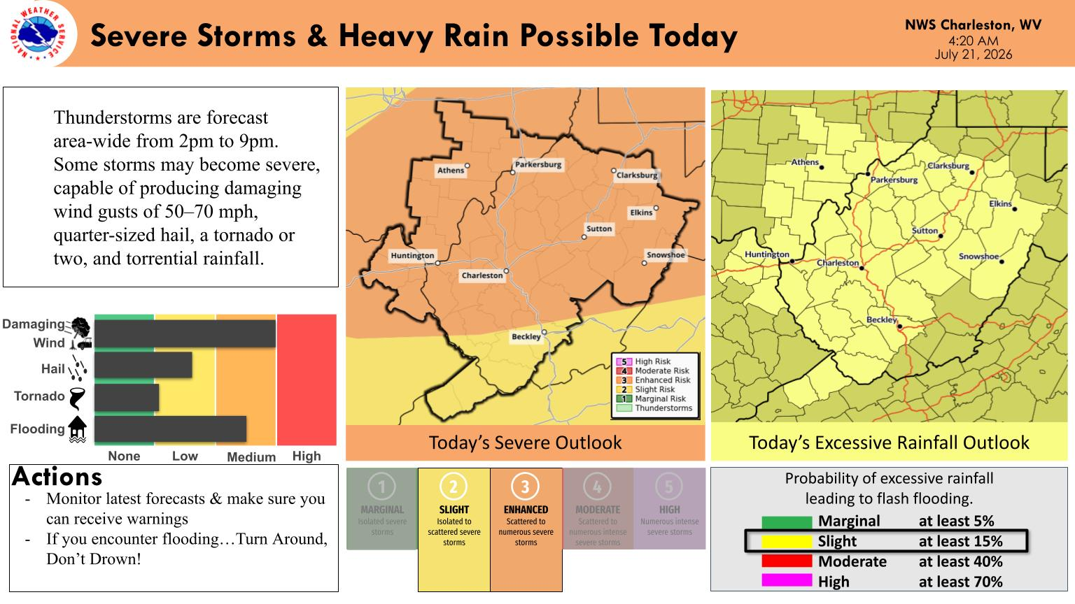
Heavy rainfall is also expected, with torrential downpours that may lead to highly localized flooding and flash flooding in some areas.
In addition to strong winds and heavy rain, the National Weather Service says a line-embedded tornado or two is possible, along with isolated quarter-sized hail.
Much of the state is under a slight risk for severe thunderstorms, while northern and central portions of West Virginia are under an enhanced risk. A slight risk of excessive rainfall also exists across portions of the region, increasing the potential for localized flash flooding.
The National Weather Service encourages residents to closely monitor the latest forecasts, ensure they have multiple ways to receive weather warnings, and never drive through flooded roadways.
“Turn Around, Don’t Drown,” the agency said.


