



CHARLESTON, WV (LOOTPRESS) – The National Weather Service in Charleston is warning that an enhanced risk of severe weather is expected across most of West Virginia on Tuesday, with forecasters citing the potential for widespread damaging storms from Tuesday afternoon into Tuesday night.
According to the National Weather Service, an unseasonably strong wind field in the upper atmosphere is increasing confidence that impactful severe weather will develop as a cold front moves through the region.
Forecasters say scattered to numerous severe thunderstorms are expected to form Tuesday afternoon and evening, with some storms potentially becoming intense. While all severe weather hazards are possible, the primary threats are expected to be damaging wind gusts and heavy rainfall.
Large hail, isolated tornadoes, and localized flash flooding are also possible. The National Weather Service notes that the greatest potential for severe weather includes southeast Ohio, northeastern Kentucky, and most of West Virginia.
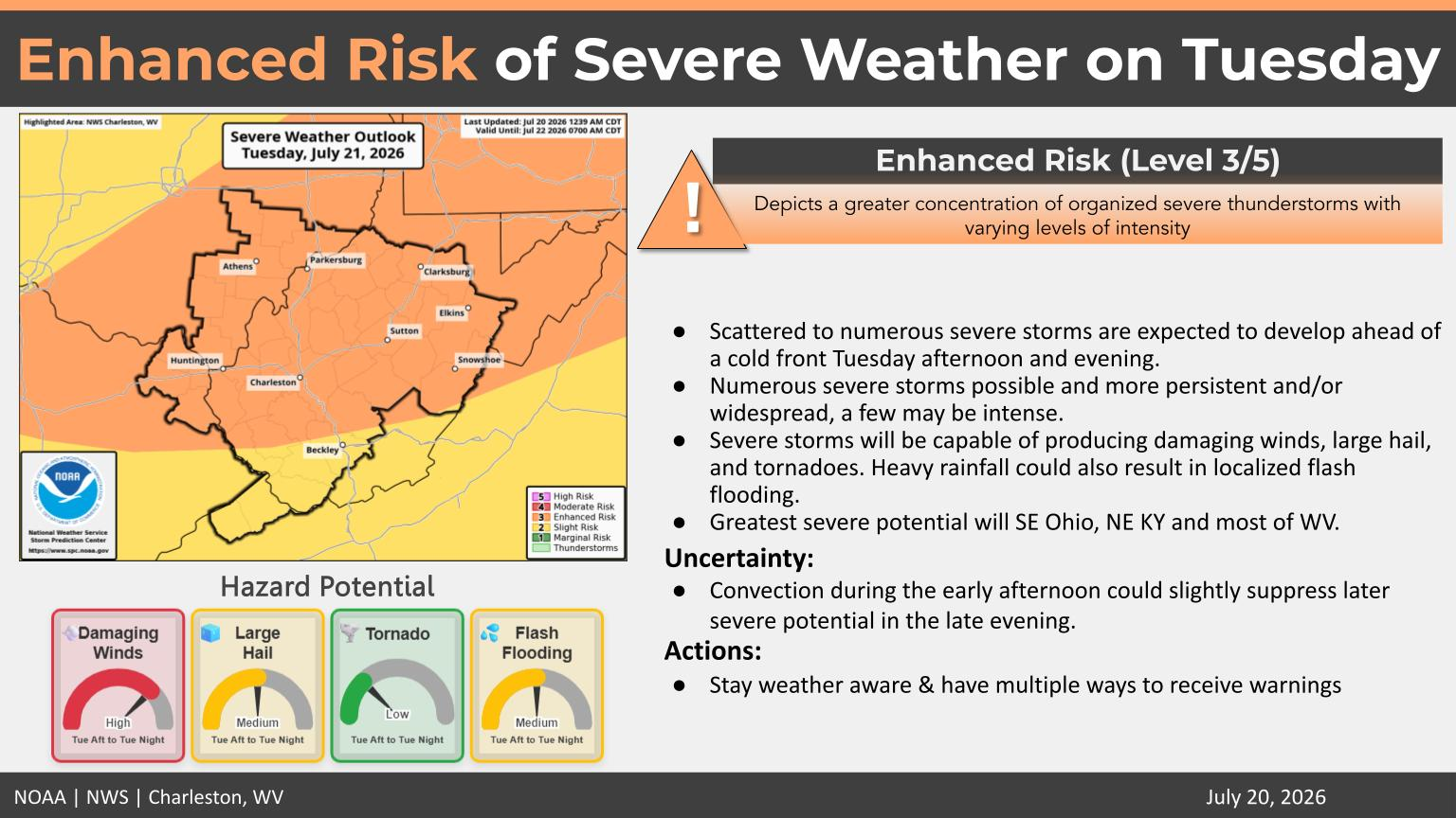
The current outlook places much of West Virginia under an Enhanced Risk (Level 3 of 5) for severe weather.
Forecasters say there is some uncertainty, as thunderstorms developing earlier in the afternoon could slightly reduce the intensity of later storms.
The National Weather Service is urging residents to closely monitor the latest forecasts and ensure they have multiple ways to receive weather warnings if they are issued.


