



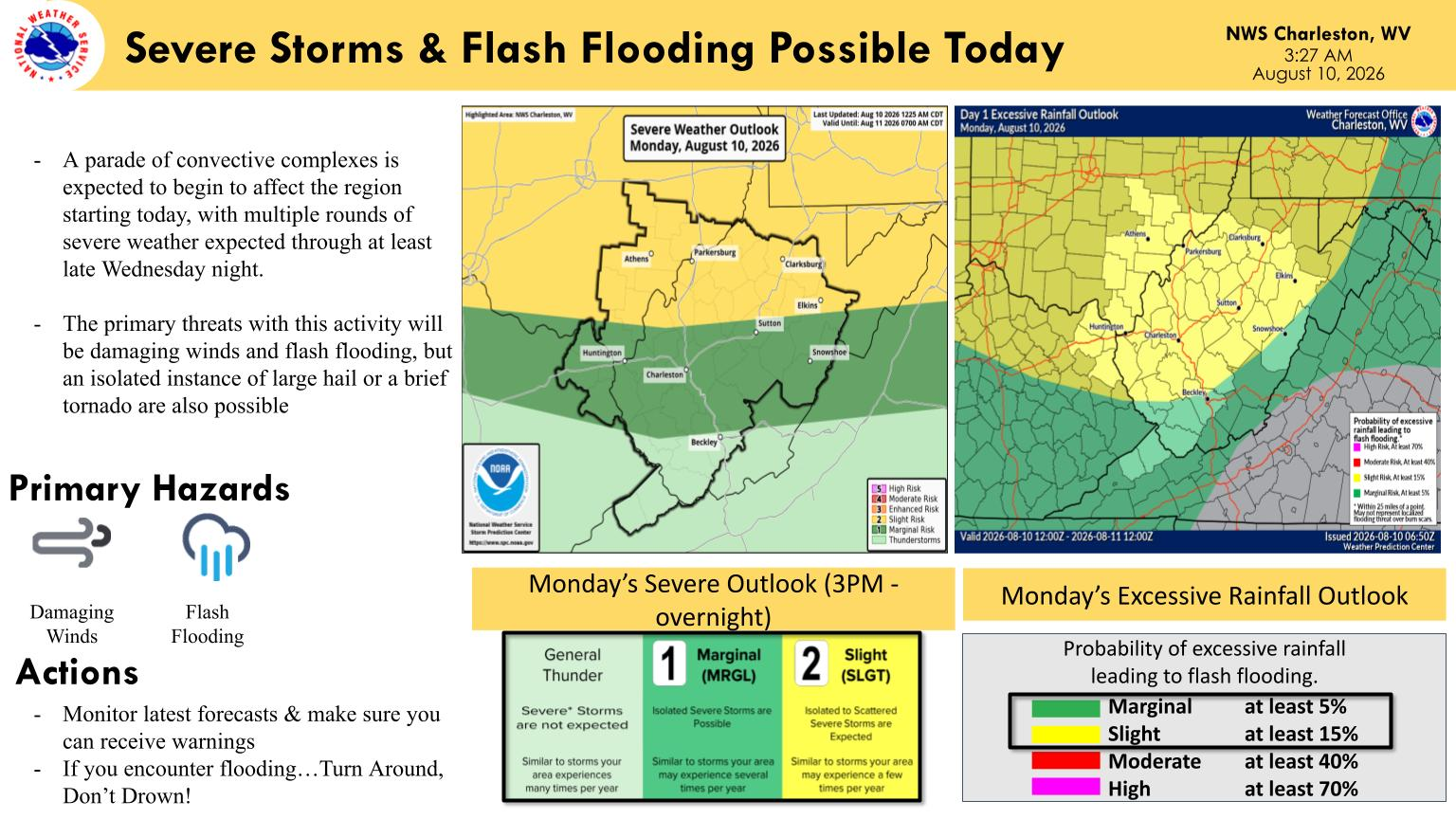
WEST VIRGINIA (LOOTPRESS) – Severe thunderstorms capable of producing damaging winds and heavy rainfall are expected across much of West Virginia beginning Monday afternoon and continuing into the night, according to the National Weather Service in Charleston.
Forecasters said multiple rounds of storms could move through the region, bringing a risk of damaging winds and flash flooding. An isolated instance of large hail or a brief tornado is also possible.
The National Weather Service said thunderstorms containing heavy downpours could repeatedly affect some locations, increasing the potential for flash flooding through Monday night.
Much of the region is under a slight risk for severe thunderstorms Monday, while portions of southern West Virginia are under a marginal risk, according to the National Weather Service outlook.
Forecasters are urging residents in flood-prone areas to be prepared to move to higher ground if water begins to rise. Drivers should also use caution because the depth of water covering a roadway can be difficult to determine.
The National Weather Service advises motorists who encounter flooded roads to “Turn Around, Don’t Drown.”
The unsettled weather pattern is expected to continue, with multiple rounds of severe weather possible through at least late Wednesday night.


