WEST VIRGINIA (LOOTPRESS) – A developing winter weather system is expected to impact the region late tonight through Tuesday afternoon, bringing a challenging mix of snow, sleet, and freezing rain across southeast Ohio, northeast Kentucky, and much of West Virginia.
Forecasters say the most significant snowfall will likely occur across southeast Ohio and northwest West Virginia, while a corridor of impactful freezing rain is expected from northeast Kentucky through west-central and north-central West Virginia, as well as along the eastern slopes of the mountains.
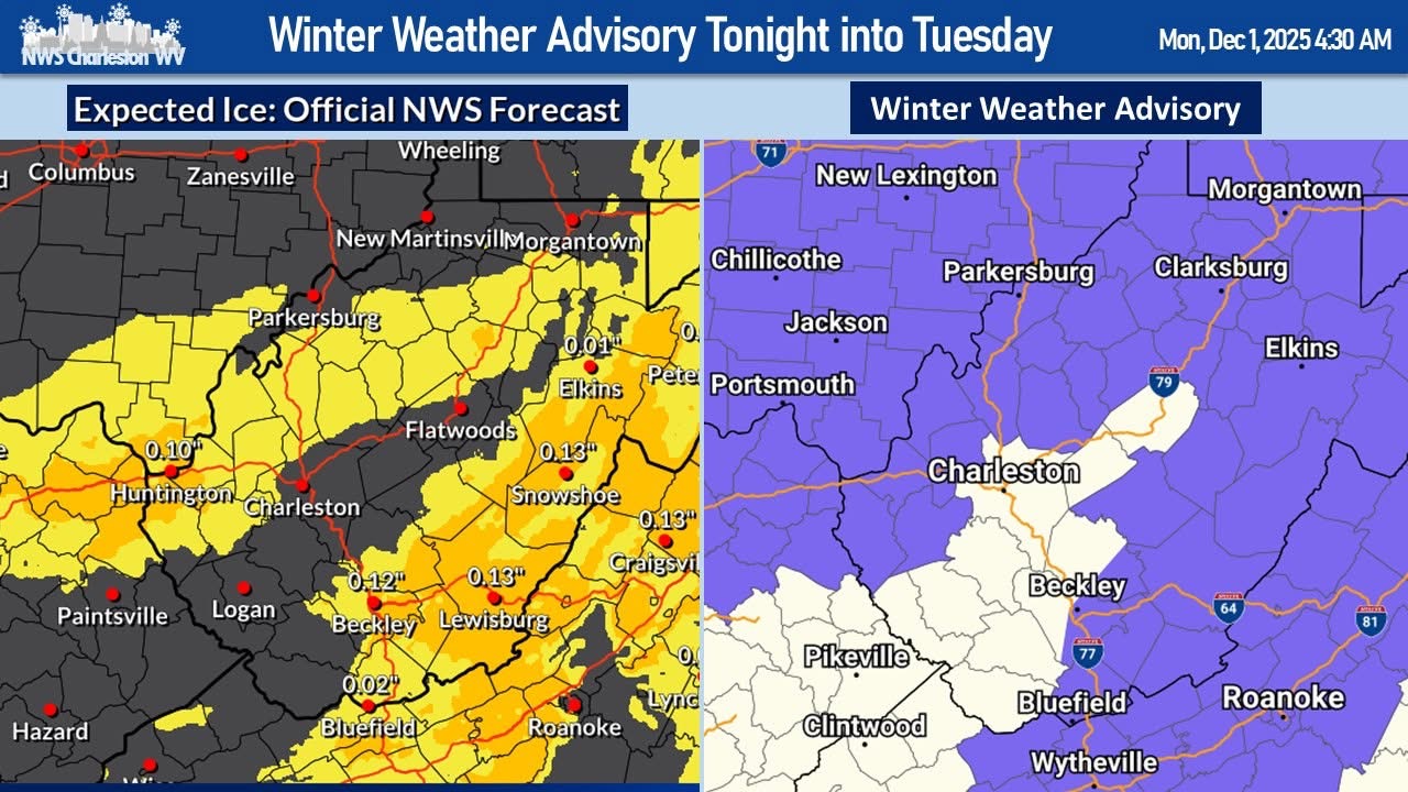
The National Weather Service has issued a WINTER WEATHER ADVISORY from 11 PM tonight to 1 PM EST Tuesday for a large portion of the region.
Expected Conditions
According to the advisory:
- What: Mixed precipitation, including snow, sleet, and freezing rain
- Snow Accumulation: Up to 2 inches possible
- Ice Accumulation: Up to 0.10 inches
- Where: Portions of northeast Kentucky, southeast Ohio, and central, northeast, northern, southern, southeast, and western West Virginia
- When: 11 PM tonight through 1 PM Tuesday
Impacts
Travel may become difficult or even dangerous, especially during the Tuesday morning commute. Roads are likely to become slick as snow mixes with freezing rain, creating icy surfaces that could lead to hazardous driving conditions.
Forecasters caution that even light ice accumulation can cause significant problems on untreated roads, bridges, and overpasses.
Safety and Preparedness
Authorities are urging residents to:
- Slow down and allow extra travel time
- Use caution while driving overnight and Tuesday morning
- Check the latest road conditions by dialing 511 or visiting state transportation websites
With wintry precipitation expected to continue into midday Tuesday for many locations, residents are encouraged to stay informed and plan travel carefully.