WEST VIRGINIA (LOOTPRESS) – A new round of winter weather is set to move into the region late tonight, bringing accumulating snow that will continue through Monday and could create hazardous travel conditions, especially for the Monday morning commute.
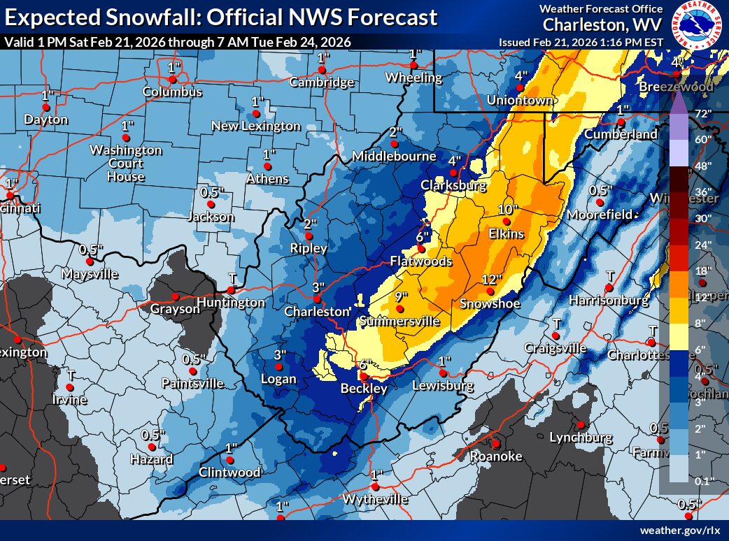
Forecasters say several inches of snow are expected across the lowlands, while the higher elevations of the West Virginia mountains could see significant totals approaching a foot. Snowfall will begin overnight, gradually increasing in coverage and intensity on Sunday.
The most impactful period is expected Sunday night into early Monday morning, when steady snowfall and reduced visibility may lead to slick roads and slow travel. Commuters should allow extra time, check road conditions, and be prepared for possible delays.
Officials urge residents to plan ahead, use caution while driving, and stay updated on the latest forecasts and advisories as the storm develops.