



WEST VIRGINIA (LOOTPRESS) – The National Weather Service in Charleston says multiple rounds of strong to severe thunderstorms are expected to impact West Virginia through Tuesday, bringing the threat of damaging winds, heavy rainfall and localized flash flooding.
Forecasters say a complex of storms is expected to move into the region Monday evening and continue through the overnight hours. Damaging wind gusts will be the primary hazard, while heavy rainfall could produce localized flash flooding.
The highest risk Monday is expected between 6 p.m. and 9 p.m. across southeast Ohio, northeast Kentucky and western West Virginia. The remainder of the forecast area is expected to see storms between 9 p.m. and 2 a.m., with showers and thunderstorms continuing into Tuesday morning.
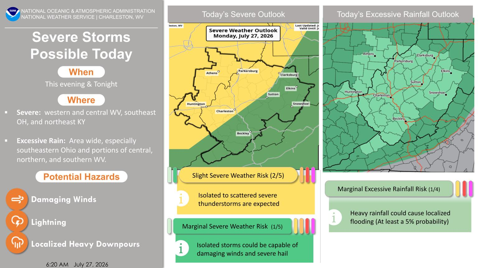
The National Weather Service says another round of severe weather is possible Tuesday afternoon and evening, although some uncertainty remains regarding the timing as storms from Monday night move out of the area.
If storms redevelop Tuesday, forecasters say damaging wind gusts, large hail and an isolated tornado will be the primary severe weather threats. Heavy rainfall could also lead to additional localized flash flooding.
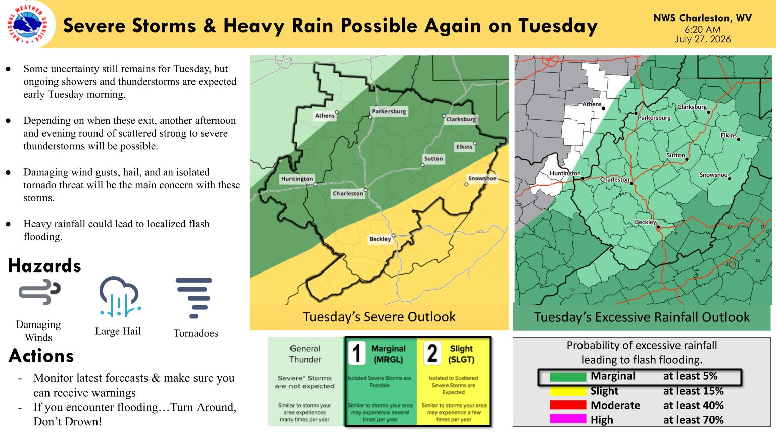
The Storm Prediction Center has placed much of southern and central West Virginia under a slight risk (Level 2 of 5) for severe thunderstorms Tuesday, with surrounding areas under a marginal risk (Level 1 of 5). The Weather Prediction Center has also issued a marginal risk (Level 1 of 4) for excessive rainfall, indicating a continued threat of localized flash flooding.
Residents are encouraged to monitor the latest forecasts and have multiple ways to receive weather warnings through Tuesday as conditions evolve.


