(LOOTPRESS) – Weather radar is a vital tool for tracking storms and understanding changing weather conditions. The colorful maps often displayed on television and apps provide valuable information about precipitation, storm intensity, and movement. But what do these colors really mean? Here’s a guide to help you interpret weather radar maps.
The Basics of Radar Imagery
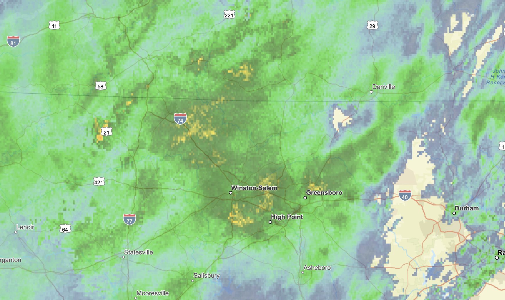
Weather radar works by emitting radio waves that bounce off precipitation particles, such as raindrops, snowflakes, or hailstones, and return to the radar receiver. The strength of the returned signal, called reflectivity, determines the intensity of precipitation. These signals are translated into colors that represent the type and amount of precipitation falling.
Radar Color Key
- Light Green to Dark Green
- Indicates light precipitation, such as drizzle or light rain.
- Typically represents less than 0.1 inches of rain per hour.
- Yellow to Orange
- Reflects moderate to heavy precipitation.
- This could mean steady rain or a strong storm.
- Caution is advised, as heavier downpours may cause localized flooding.
- Red
- Signifies very heavy rain or a severe thunderstorm.
- Often associated with intense weather systems, including strong winds and potential flash flooding.
- Pink or Purple
- Suggests mixed precipitation, such as sleet or freezing rain.
- May also indicate hail within a storm.
- This color alerts drivers and pedestrians to icy conditions.
- White or Blue Shades
- Denotes snow or other frozen precipitation.
- The intensity can vary, with darker blues or purples showing heavier snowfall.
Special Radar Indicators
- Black or Grey “Holes”
- Areas with no precipitation detected.
- Could also occur if the radar beam is blocked or unable to detect activity in that zone.
- Bright Bands or Lines
- Radar sometimes shows bands of color that aren’t precipitation but atmospheric phenomena, such as temperature inversions or dust.
Severe Weather Alerts and Radar
Meteorologists use radar data to issue warnings for dangerous weather. When radar colors show rapid intensification (e.g., a transition from yellow to red or purple), it can signal a developing severe storm or tornado. Advanced radars, like Doppler radar, can even measure wind direction within storms, helping forecasters identify rotation.
How to Stay Safe
Understanding radar colors can help you plan your day and stay safe during extreme weather. Pay close attention to weather alerts and advisories that accompany radar updates.
For more detailed information, visit the National Weather Service’s radar interpretation guide at weather.gov.
Stay informed and prepared, and always trust your local meteorologists for the latest updates!