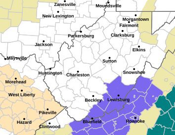
(LOOTPRESS) – The National Weather Service in Blacksburg has issued a Winter Weather Advisory for portions of northwest North Carolina, southwest and west-central Virginia, and southeast West Virginia as another early-December storm system approaches the region.
The advisory goes into effect 1 a.m. Monday and remains in place through 1 a.m. Tuesday.
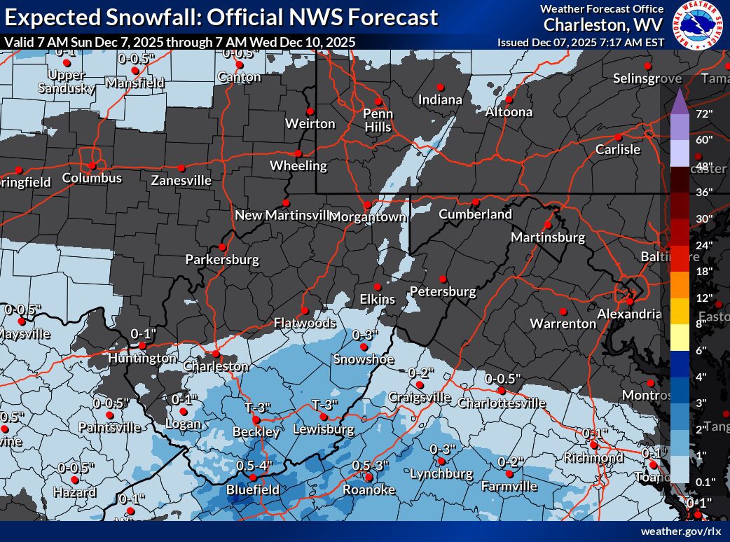
Snowfall Expected Overnight Into Monday
Forecasters expect 1 to 3 inches of snow across much of the advisory area, with higher totals possible in elevations above 3,000 feet. Areas included in the alert stretch from Ashe, Alleghany, and Watauga counties in North Carolina northward through Tazewell, Bland, Giles, Montgomery, Roanoke, Rockbridge, and Bath counties in Virginia, and into Mercer, Summers, Monroe, and Greenbrier counties in West Virginia.
Communities such as Boone, Blacksburg, Roanoke, Wytheville, Bluefield, Lewisburg, Covington, and Galax are among those under the advisory.
Travel Could Be Impacted
Roads may become slick, especially overnight and during the day on Monday. The National Weather Service cautions that hazardous conditions could impact both the Monday morning and evening commutes, particularly along secondary roads and higher-elevation corridors.
Safety Tips
Residents are encouraged to:
-
Allow extra time for travel
-
Reduce speed on snow-covered or untreated roads
-
Check updated travel conditions by dialing 511 for state roadway information
This storm marks another round of early-season winter weather for the region as temperatures remain favorable for accumulating snowfall.