
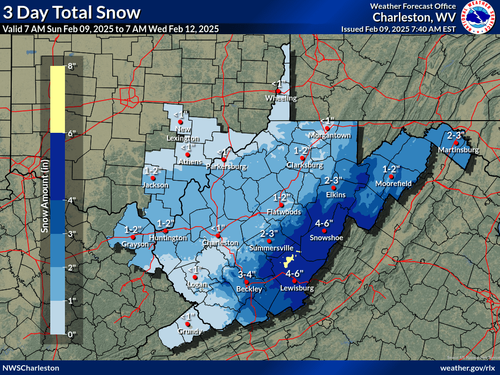
WEST VIRGINIA (LOOTPRESS) – Residents can expect lingering showers this morning before a brief period of dry and seasonably cool conditions through Monday. However, another strong weather system is set to move in Monday night, bringing significant precipitation across the region through Tuesday night.
Forecasters warn that depending on the system’s track, some areas could experience heavy snowfall, though rain is expected to mix in at times, especially in lower elevations. The exact snowfall totals remain uncertain, but meteorologists advise residents to prepare for potential winter weather impacts.
The active weather pattern is expected to persist, with another system likely bringing additional precipitation by mid-week. With already saturated soil conditions and ongoing flooding concerns, officials urge residents to stay alert for potential flood risks in low-lying and flood-prone areas.
Stay tuned to local forecasts for updates as the storm approaches.