WEST VIRGINIA (LOOTPRESS) – A Flood Watch is in effect across most of West Virginia on Monday as forecasters warn that repeated rounds of heavy rain could lead to flash flooding, while some thunderstorms may become severe with damaging winds, large hail and an isolated tornado.
The National Weather Service has issued the Flood Watch beginning at 8 a.m. for much of the state, with additional watches beginning at noon for parts of southeastern West Virginia. The watches remain in effect through Monday evening.
The watch includes much of central, southern and western West Virginia, including Cabell, Wayne, Mason, Putnam, Kanawha, Jackson, Wood, Pleasants, Tyler, Lincoln, Logan, Boone, Clay, Braxton, Gilmer, Lewis, Harrison, Taylor, McDowell, Wyoming, Mingo, Barbour, Upshur, Raleigh, Fayette, Nicholas, Webster, Pocahontas, Randolph, Mercer, Summers, Monroe and Greenbrier counties.
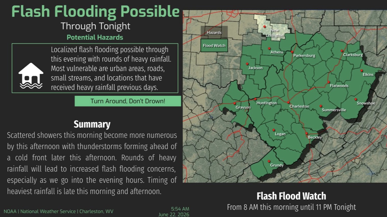
Forecasters say widespread rainfall totals of 1 to 2 inches are expected, with locally higher amounts possible where multiple rounds of showers and thunderstorms move over the same locations. Areas that received heavy rainfall last week are considered especially vulnerable to flash flooding due to already saturated ground.
In addition to the flooding threat, some thunderstorms this afternoon and evening could become strong to severe, producing damaging wind gusts, hail and a brief tornado.
Excessive rainfall may cause rivers, creeks and streams to rise quickly, with flooding also possible in low-lying areas, locations with poor drainage and flood-prone roadways.
Residents are urged to monitor the latest forecasts and be prepared to act if Flash Flood Warnings or Severe Thunderstorm Warnings are issued. Motorists should never drive through flooded roadways, as water depths can be difficult to judge and conditions can change rapidly.