



CHARLESTON, WV (LOOTPRESS) – A Flood Watch remains in effect across much of West Virginia through Sunday evening, with the National Weather Service warning that excessive rainfall could lead to flash flooding in many areas of the state.
According to the National Weather Service offices in Charleston and Blacksburg, abundant moisture combined with showers and thunderstorms will create the potential for heavy rainfall capable of producing flash flooding.
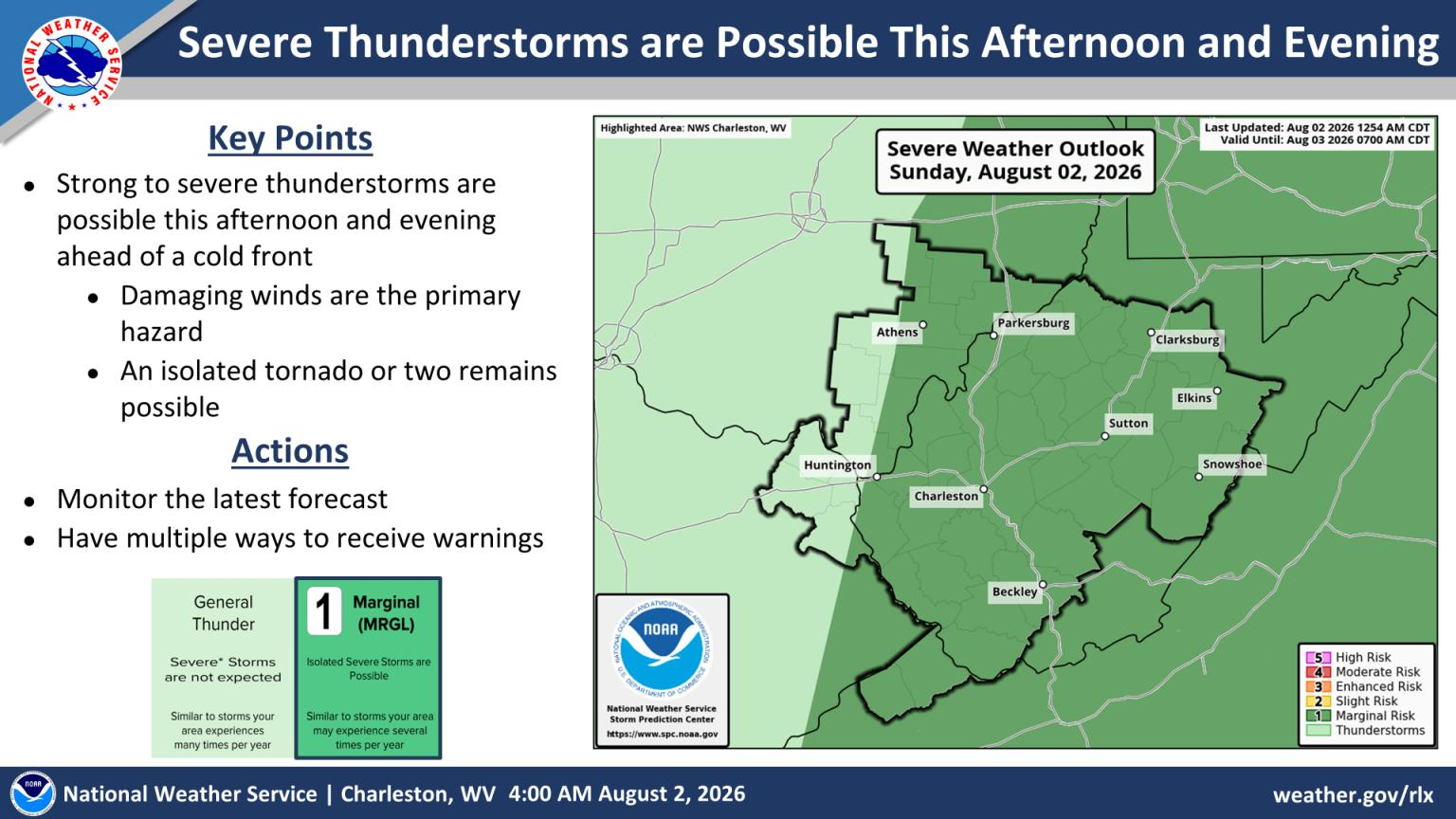
Forecasters say damaging wind gusts are also the primary severe weather threat Sunday afternoon and evening, with an isolated tornado also possible.
The Flood Watch covers a large portion of the state, including counties across central, northern, southern, northeastern and southeastern West Virginia. Areas under the watch include Kanawha, Putnam, Jackson, Wood, Pleasants, Tyler, Lincoln, Roane, Wirt, Calhoun, Ritchie, Doddridge, Logan, Boone, Clay, Braxton, Gilmer, Lewis, Harrison, Taylor, McDowell, Wyoming, Upshur, Barbour, Fayette, Raleigh, Nicholas, Webster, Pocahontas, Randolph, Mercer, Summers, Monroe and Greenbrier counties.
Forecasters said excessive runoff could cause flooding along rivers, creeks and streams, as well as in low-lying and flood-prone areas. Poor drainage locations and areas repeatedly impacted by thunderstorms are expected to face the greatest flood risk.
Communities identified as being among those that could experience flooding include Charleston, Parkersburg, Beckley, Clarksburg, Elkins, Buckhannon, Grafton, Weston, Summersville, Ripley, Madison, Philippi, Fayetteville, Welch, Spencer, Winfield, Richwood, Lewisburg, White Sulphur Springs, Bluefield and Hinton.
The National Weather Service also warned that strong to severe thunderstorms are possible Sunday afternoon and evening ahead of a cold front. Damaging winds are expected to be the primary hazard, although an isolated tornado or two cannot be ruled out.
Residents are encouraged to monitor the latest forecasts, have multiple ways to receive weather warnings, and be prepared to take action if Flash Flood Warnings or Severe Thunderstorm Warnings are issued. Those living in flood-prone areas should remain alert for rapidly changing conditions.


