WEST VIRGINIA (LOOTPRESS) – West Virginians should prepare for a round of heavy rain and potentially severe thunderstorms beginning late Sunday night and continuing through Monday as a strong weather system moves across the state.
According to the National Weather Service in Charleston, the greatest threat is expected Monday afternoon and evening, when strong to severe thunderstorms could develop. Damaging wind gusts are the primary hazard, although large hail and an isolated tornado are also possible.
Much of West Virginia is under a marginal risk, or Level 1 of 5, for severe weather on Monday.
In addition to the severe storm threat, heavy, soaking rainfall could lead to localized flash flooding from Monday into early Tuesday. Most of the state is under a slight risk, or Level 2 of 4, for excessive rainfall, meaning scattered instances of flash flooding are possible, particularly in low-lying and poor drainage areas.
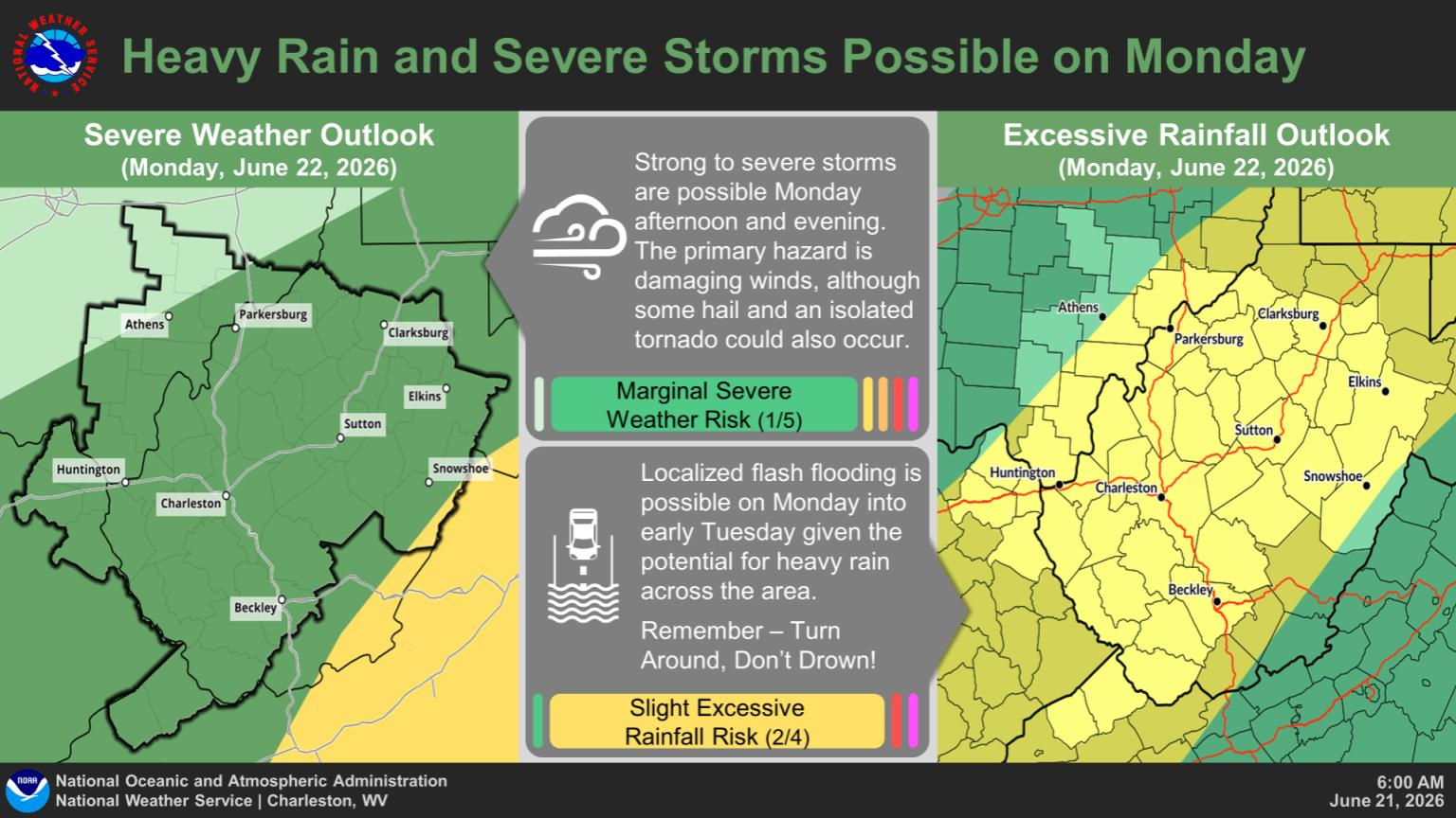
Forecasters urge residents to remain weather-aware, monitor the latest forecasts, and never drive through flooded roadways. Officials remind motorists to “Turn Around, Don’t Drown.”
Conditions are expected to improve after the system moves through, with drier weather forecast for Tuesday and Wednesday before another unsettled weather pattern develops later in the week.