CHARLESTON, WV (LOOTPRESS) – The National Weather Service’s Storm Prediction Center has issued a Severe Thunderstorm Watch for portions of northern West Virginia through 9 p.m. Saturday.
The watch includes the following West Virginia counties:
BARBOUR              BERKELEY            BRAXTON
FAYETTE              GRANT               GREENBRIER
HAMPSHIRE            HARDY               HARRISON
JEFFERSON            LEWIS               MERCER
MINERAL              MONROE              MORGAN
NICHOLAS             PENDLETON           POCAHONTAS
RALEIGH              RANDOLPH            SUMMERS
TAYLOR               UPSHUR              WEBSTER
According to the National Weather Service in Charleston, thunderstorms are expected to develop this afternoon and evening, with the primary threats being damaging wind gusts and localized flash flooding.
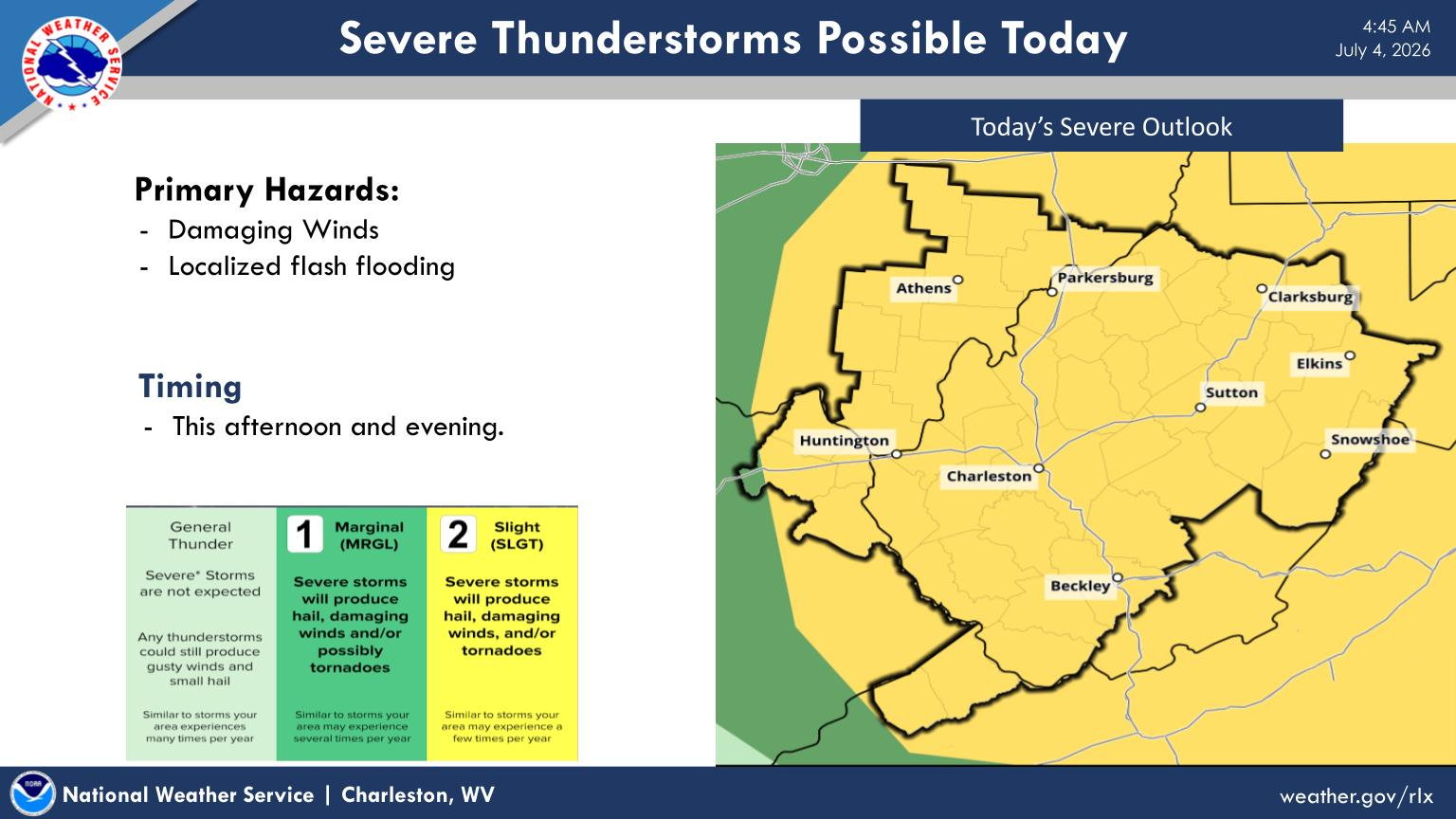
The severe weather outlook places much of West Virginia under a Slight Risk (Level 2 of 5) for severe thunderstorms, meaning isolated severe storms are possible.
While widespread severe weather is not expected, some storms could produce damaging winds, hail, and heavy rainfall capable of causing localized flooding.
A Severe Thunderstorm Watch means conditions are favorable for severe thunderstorms to develop. Residents in the affected counties are encouraged to monitor the latest forecasts and be prepared to seek shelter if warnings are issued.