WEST VIRGINIA (LOOTPRESS) – West Virginia residents can expect a gradual warming trend through the middle of the week, but forecasters are also warning of an increasing risk of severe weather beginning Wednesday night and continuing into Thursday.
According to the National Weather Service in Charleston, most of Wednesday is expected to remain dry. However, the threat of strong to severe thunderstorms will increase Wednesday night and persist into Thursday.
Damaging winds are expected to be the primary hazard, though forecasters say other severe weather threats, including large hail and isolated tornadoes, cannot be ruled out. Localized flash flooding is also possible, especially in areas that experience repeated rounds of heavy rainfall.
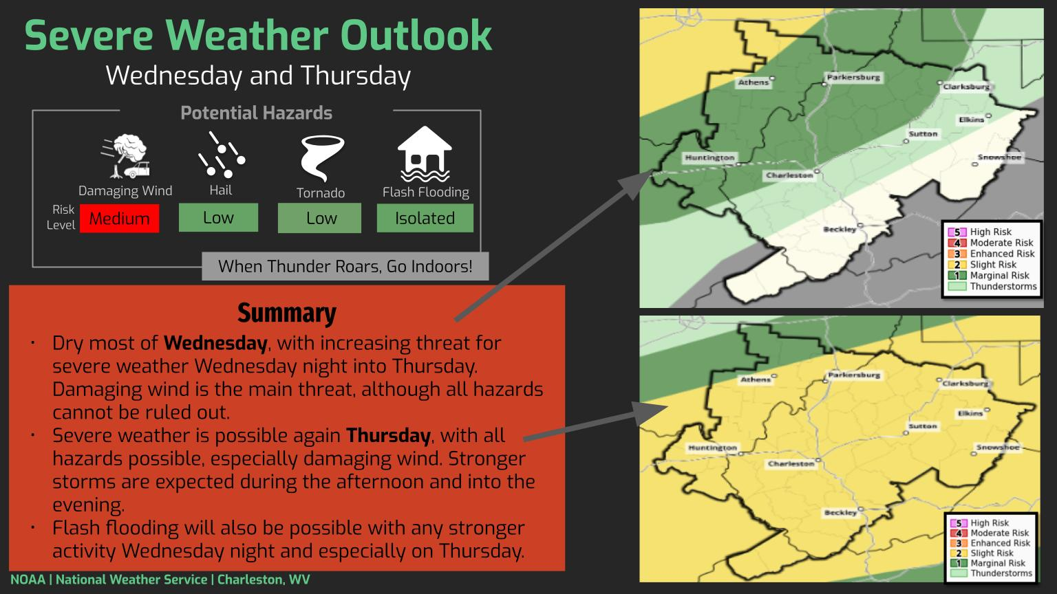
The severe weather threat is expected to be greatest Thursday afternoon and evening, when stronger storms could develop across much of the state. All severe weather hazards will be possible during that time, with damaging winds remaining the main concern.
The National Weather Service is also highlighting the potential for localized flooding Wednesday night and particularly on Thursday as thunderstorms move through the region.
A cold front is expected to move through the state late Thursday, bringing cooler temperatures by Friday.
Residents are encouraged to monitor the latest forecasts, have multiple ways to receive weather warnings, and be prepared to seek shelter if severe weather develops. Forecasters remind the public that when thunder roars, it is safest to move indoors.